
by Nick Russo, Senior Transportation Planner
The idea of a continuous, connected, low-stress bicycling route through Berkshire County has persisted for decades. Connecting our major town and village centers with a real cycling option would provide an alternative to the notorious congestion and parking crunch in the summer months and would lower the cost of transportation for workers and shoppers.
After getting a unique opportunity to visit continental Europe this summer and cycle over 160 miles around southern Germany and the Netherlands, there were many examples that stood out to me for what could be brought back to the Berkshires. Solutions that we may not have considered as thoroughly up to this point should be worked into the Berkshire Bike Path plan. These include (1) regionwide bicycle wayfinding systems, (2) a reimagining of how the highway right-of-way could be allocated for driving, cycling, and walking, and (3) smart ways of sharing existing streets where appropriate.
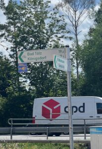

Wayfinding signs in Germany (left) and the Netherlands (right) provided guidance and reassurance while navigating on both rural country roads and dense urban cities.
Navigating around Berkshire County by bike can be different than by car. With e-bikes now a staple offering at most bike shops, the Berkshire Hills need no longer be seen as a barrier for cycling in the region. And trust me, from my experience – climbing a hill with or without an e-bike on a safer, quieter back road or separated bike path just feels easier than hugging the shoulder on a main highway with traffic whizzing past. Navigating the back roads of Berkshire County can be a relatively easy venture with a robust system of wayfinding. In my travels in Europe, nearly every junction along the designated cycling network had a guide sign to keep me going in the right direction.
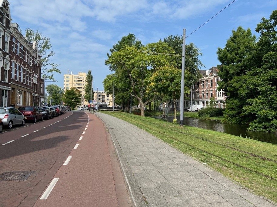
The way our highway rights-of-way are designed is another opportunity to improve cycling and walking options. The jewel in the crown for the Berkshire Bike Path project is, of course, the Ashuwillticook Rail Trail. There is nowhere better to go for a serene, enjoyable ride or walk in the region. It’s also safe and makes me feel my existence on a bike is justified and dignified. And I think that is the secret sauce to make a successful Berkshire Bike Path. I will cycle pretty much anywhere, but there is something to be said about how Route 8, with bike lanes, runs parallel to the Rail Trail, but I will choose the Rail Trail every time. On Route 8, I will likely be baking in the sun, inhaling exhaust and brake dust, and only listening to traffic noise. So, while bicycles are certainly accommodated on Route 8 to the letter of the engineering standards, it’s not a route I would recommend to anyone.
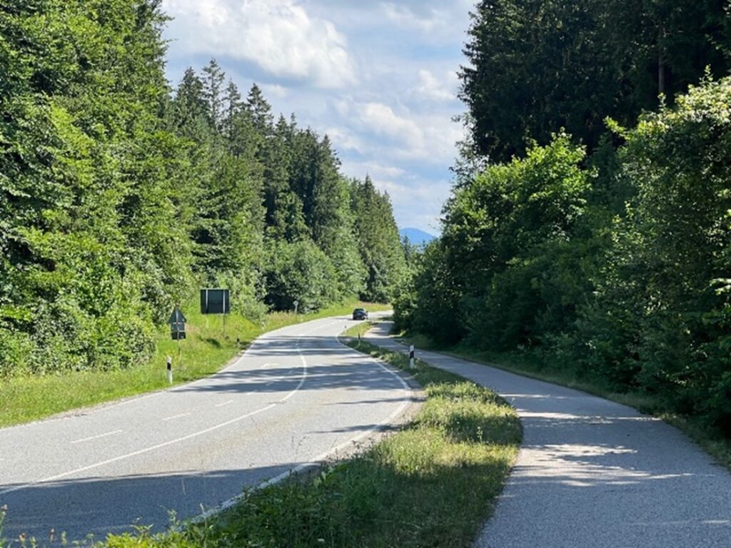
Not everywhere in Berkshire County has an alternative option to the state highway, like a Rail Trail, though. And while not every state highway needs to be retrofitted with bike lanes or a sidepath, in my opinion, there should be at least one offering of a high-quality bike and pedestrian route via state right-of-way. One good example is Route 102, designated as a component of the Berkshire Bike Path. Currently, the road has no sidewalk beyond South Lee and two wide shoulders serving as bike lanes between downtown Lee and Stockbridge. This existing pavement width could easily be reconfigured into two vehicle travel lanes and a fully separated sidepath for cycling and walking that gets people off the road. During the summer trip through Germany this year, I saw just this arrangement on a rural provincial highway.
An example of what this could look like on Route 102 through South Lee can be seen in the GIF below. The existing width of the pavement could be cut, re-graded, and micro-surfaced to create a new layout within the same footprint. (Please note, the image will shift from the current roadway layout to a potential re-working, but the shift may be delayed depending on the speed of your internet connection.)
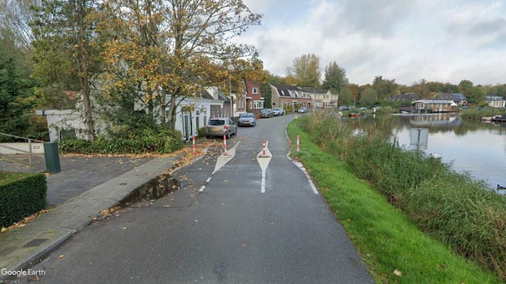
Sharing the street is also a viable option when the right conditions and design come together. On my long-distance ride between Rotterdam and Amsterdam, many great cycling streets were created by simply not allowing through traffic on neighborhood streets, while allowing bicycles and pedestrians to filter through. This “modal filter” is a simple, cost-effective way to create great streets for walking, cycling, and boosting quality of life.
On a recent cycle trip from Pittsfield to Connecticut, I saw a similar example of a modal filter in Great Barrington and Sheffield. With the closure of the Brookside Bridge, Boardman Street became a de facto dead-end street with only local traffic. This closely resembled the travel ways I used in Germany and the Netherlands. The farrhadsraße and fietsstraat “bicycle streets” in those regions are roads shared by all modes of travel, but bicycles have priority. They work best where the only traffic is local, low speed, and low volume. Similar “bicycle boulevards” in the United States have also been implemented successfully. Planning is key in order to be sure they are cohesive and connected to a wider network. It needs to be considered at a regional level, beyond town and city borders.
The work continues, and BRPC’s Transportation Planning team is looking forward to continuing to develop the Berkshire Bike Path and wider network, both north and south of the existing Ashuwillticook Rail Trail. Look forward to more updates this fall.